The purpose of the BMS Interactive map was to present a navigation and planning chart for selected BMS terrain. These charts should be viewable from computer for briefing/debriefing purposes but also from tablets for consultation in flight.
These charts featured:
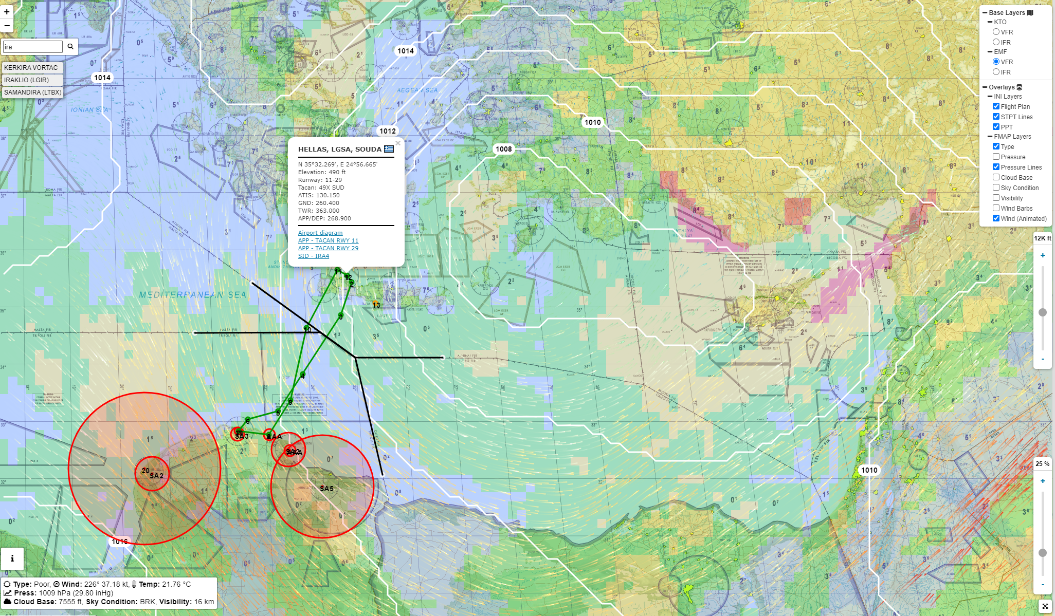
- Zoomable and draggable ONC (Operational Navigation Chart) style layout at 4096×4096 resolution.
- VFR/IFR layer map.
- Airbase/Airstrip/Vortac position – clicking the icon will open a popup with radio frequencies, navigation data and a link to airbase charts.
- Search for specific airbases using name or ICAO code.
- Mission.ini file support: Drag and Drop a TE.ini file in the map to display relevant mission PPTs & lines.
- Weather support: Drag and Drop a Fmap file in the map to display multiple layers for weather such as:
BMS type weather, winds, isolines, pressure, clouds base, sky conditions, visibility. - Cursor data: get elevation at cursor and weather at cursor (when fmap is loaded)
- Route planning support: Use the route planning options on the left margins to trace routes or area and get the MEF (Maximum Elevation Figures) in that area or 5Nm either side of the route.
2 BMS terrain had their own dedicated Interactive map: BMS KTO 4.35 & BMS EMF 4.35
Unfortunately considering the way my past 20 years contributions have been treated by the new BMS dev group I had to switch the interactive maps off to protect my intellectual property.
It is a shame because the interaction we had on these map was unique and never such a thing was created for a simulator before.